Eh.
- Apr 25, 2016
- 2 min read
The groundhog's useless exercise in February is always greeted with considerable, unearned fanfare, however regardless of when the snow stops falling and when Spring "begins", it seems pretty much a given that in our neck of the woods, long stretches of awesome spring weather are usually hard to come by and Spring is frequently delayed until Summer arrives. There are so many potential killjoys out there, that it's hard to not run into one or two of them on a fairly regular basis. Lingering cold air from northerly latitudes, upper level troughs, blocking patterns, and of course the infamous ocean flow or sea-breeze coming in off the chilly, ocean water to our east and our south. We are in a pattern now that will produce near average to below average temperatures for a while, and by tomorrow, some more rain.
Image below shows GFS Forecast surface pressure & precipitation for 2 PM Tuesday
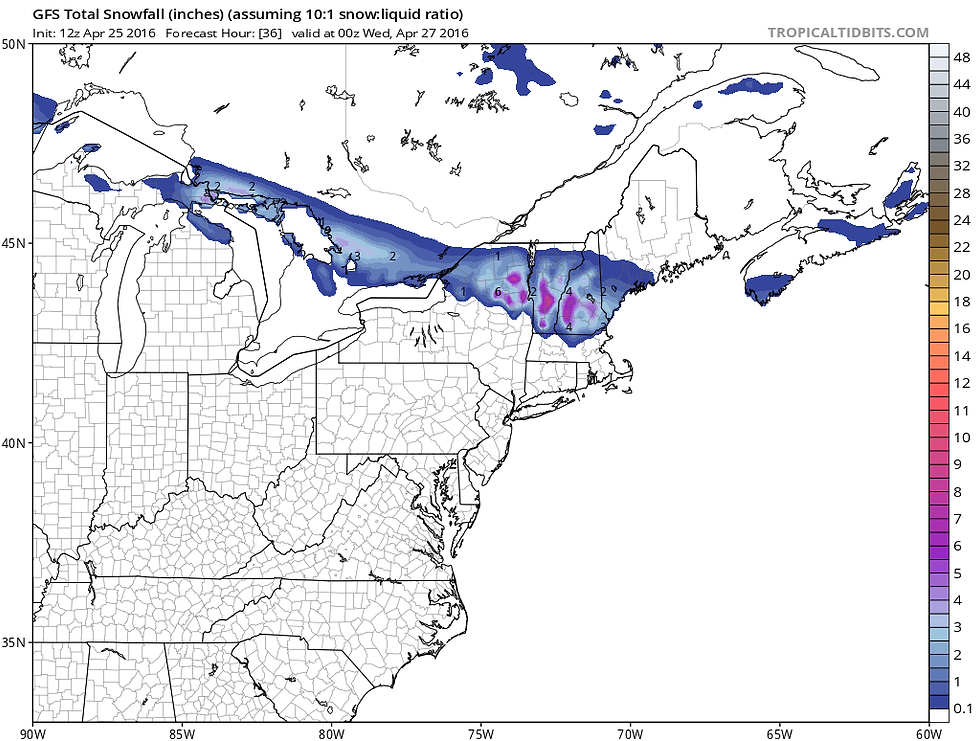
A chance for some showers will develop after midnight and we can expect periods of rain and showers Tuesday. It will also be chilly with highs mostly in the 40's across southern New England and 50's across Long Island and NYC. Temps will tend to fall during the day and there will be a bit of a raw north to northeasterly breeze. In fact, it looks like it will be cold enough for snow to fall, with some accumulation, in northern New England and northeastern New York. The GFS & ECMWF models are pretty close on the forecast snow amounts for that region - ranging from 3"-6" in some of the higher elevations of the Green Mountains and Adirondacks, down to an inch or less is some of the lower elevations.
Image below shows GFS snowfall forecast through 8 Pm Tuesday based on a 10-to-1 snow to liquid ratio. Take it with a grain of salt.

The rain will end early Tuesday night, with lows falling into the 30's in many places. Wednesday will feature lots of sun, but highs holding in the mid 50's-low 60's across the region. The models are still arguing about the most likely scenario for the end of the week, but at this point I'm thinking Thursday will be dry and showers will return Friday. Highs look to be mostly in the 50's to near 60 both days.


Comments