Arrgggh!
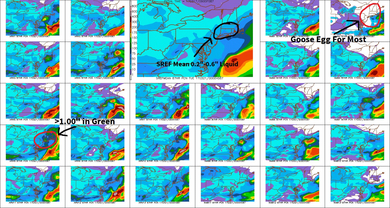
The weekend situation still has as much uncertainty now as it did yesterday. Just to give you a taste of this look at the two short-term model ensembles below. These are multiple model runs of the same model, after changing the initial conditions a little each time. By doing this, you can gauge how likely a forecast is to verify. The ensembles below (NCAR only goes through 8 PM Saturday, the SREF is weekend total) still show all possibilities ranging from no snow accumulation in parts of the region to 6 inches or more, depending on your location and how things play out. Based on everything I see on these and other arguing models, I would say that some light snow or rain (or flurries) become increasingly likely by Saturday afternoon or evening (western areas may see some in the morning). Whatever snow does reach us will probably linger into part of Sunday and could linger into late Sunday night/Monday morning in eastern portions of southern New England. As far as amounts, my best guess is 1"-4", except there may be less in the Connecticut Valley and western MA. And the possibility of 5" or more exists on Long Island, NY City, and southeastern MA, however you may also see some rain or showers in these areas during the daytime both Saturday (if it starts by then) and Sunday, which would keep the accumulation down a bit. Because of significant model differences that still exist, my confidence in this forecast is low at this time. High temperatures over the weekend will be 35-40, with lows ranging from the single numbers and teens inland to 20's along the coast tonight and in the 20's inland & low 30's at the shore Saturday night.