
Irma's Track Shifts West
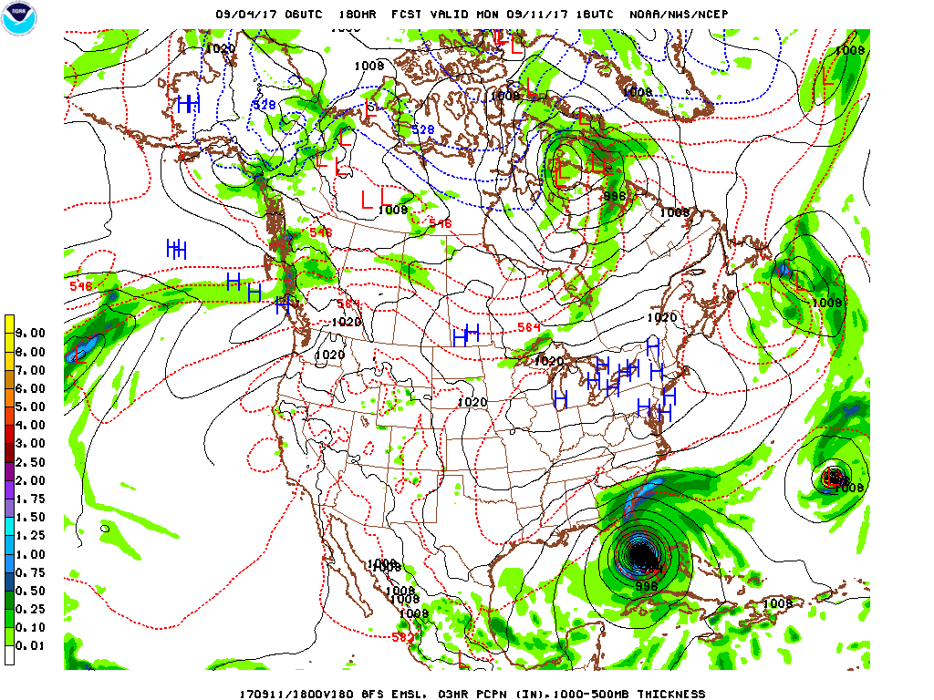
The latest available model runs have shifted the forecast track of Hurricane Irma westward before the storm is expected to curve sharply to the north. This change results in the GFS operational run taking Irma into south Florida on September 11th and the ECMWF operational run making landfall with Irma near the South Carolina/North Carolina border on September 12th. The forecast track will continue to fluctuate over the next few days, however the chances that it will make landfall somewhere in the southeastern U.S. next week have increased. The National Hurricane Center's (NHC) forecast puts the center of Irma just north of Haiti Friday morning (175 mile average NHC track error on day 4) and just north of eastern Cuba on Saturday morning (average NHC track error is 225 miles on day 5). The NHC is still forecasting the storm to reach category 4 with sustained wind up to 140 mph by Wednesday.
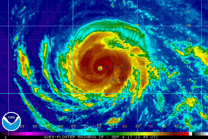
8:00 A.M. AST/EDT stats:
Max wind: 120 mph
Location of Center: ~ 610 miles east of the Leeard Islands
Motion: West-Southwest at 14 mph
Central Pressure: 947 millibars/27.93 inches
GFS Spaghetti Plots

GSF Operational Run Forecast For Sept. 11, 2 PM EDT
ECMWF Spaghetti Plots

ECMWF Operational Run Forecast For Sept. 12, 8 AM EDT

National Hurricane Center Forecast


