Evening Update on Hurricane Irma

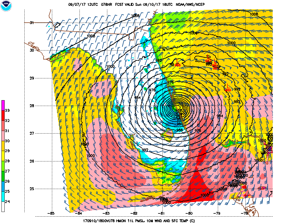
The latest model runs continue to show some of the same biases we have been seeing and it is becoming increasingly likely that Florida will feel a significant impact from this storm. The ECMWF model continues to forecast the center of the storm to track west of the GFS track. The Euro basically brings the storm right up across the Florida Peninsula, reaching south Florida by early Sunday morning and southern Georgia by late Monday. The GFS model has the center east of Miami Sunday morning, then basically hugging the east coast of Florida most of the way up, and moving inland from the Georgia coast Monday morning (see annotated track forecasts in the image above). The official NHC forecast track lies between these two solutions. For what it's worth, two of the tropical models from NCEP (pictured below) track the center in a similar fashion to the GFS. As the consensus between the models grows closer and the time frame shortens, confidence increases that the track will be in this ballpark (though certainly still not written in stone). The storm is still expected to be a major hurricane (cat 3 or higher) when it reaches south Florida.
The storm is currently a category 5 hurricane, with sustained wind up to 175 mph. The center is 40 miles east of Grand Turk Island. It is moving toward the west-northwest at 16 miles per hour. The minimum central pressure is 922 millibars/27.23 inches of mercury. A hurricane watch is in effect for parts of south Florida including the Keys and Lake Okeechobee The latest public advisory from the NHC is available here.
HWRF Tropical Model Forecast for 2 PM Sunday:

HMON Tropical Model Forecast for 2 PM Sunday: