
Update On The Storm
- Jan 4, 2018
- 1 min read
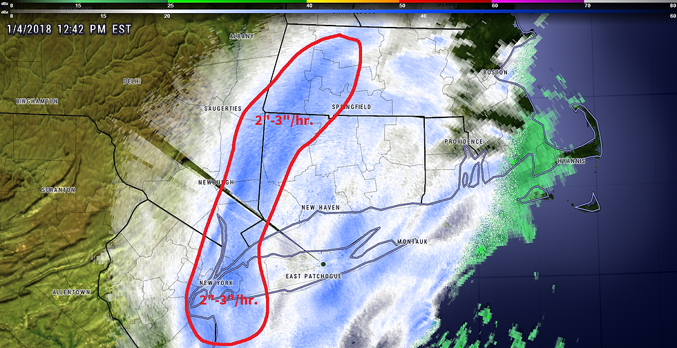
(Click To Enlarge Image).
Radar imagery and surface reports so far have not been confirming the idea of the hi-res, short-term models that have depicted a narrow corridor of the highest precipitation amounts a little east of the I-91 corridor. In fact, at the time of this writing (12:53 PM) the heaviest semi-permanent heavy snowband is actually stretching from parts of western MA, down across part of northwestern CT, and into the NY City area. Forecast snow amounts still look good, but I think the idea of the highest amounts showing up to the east is off the table.


Comments