


Summer In October Continues...
Nate has come ashore and as of this writing is a tropical storm. The center of circulation is tracking up along the Mississippi/Alabama...


Next Significant Rain?
Tropical Depression #16 has transformed into Tropical Storm Nate this morning. Nate is centered on the coast of Nicaragua and has...


Cooler After Today
Click To Enlarge This morning's weather map shows Tropical Storm Maria off the North Carolina coast and a cold front that stretches from...
Summer Afterglow Continues
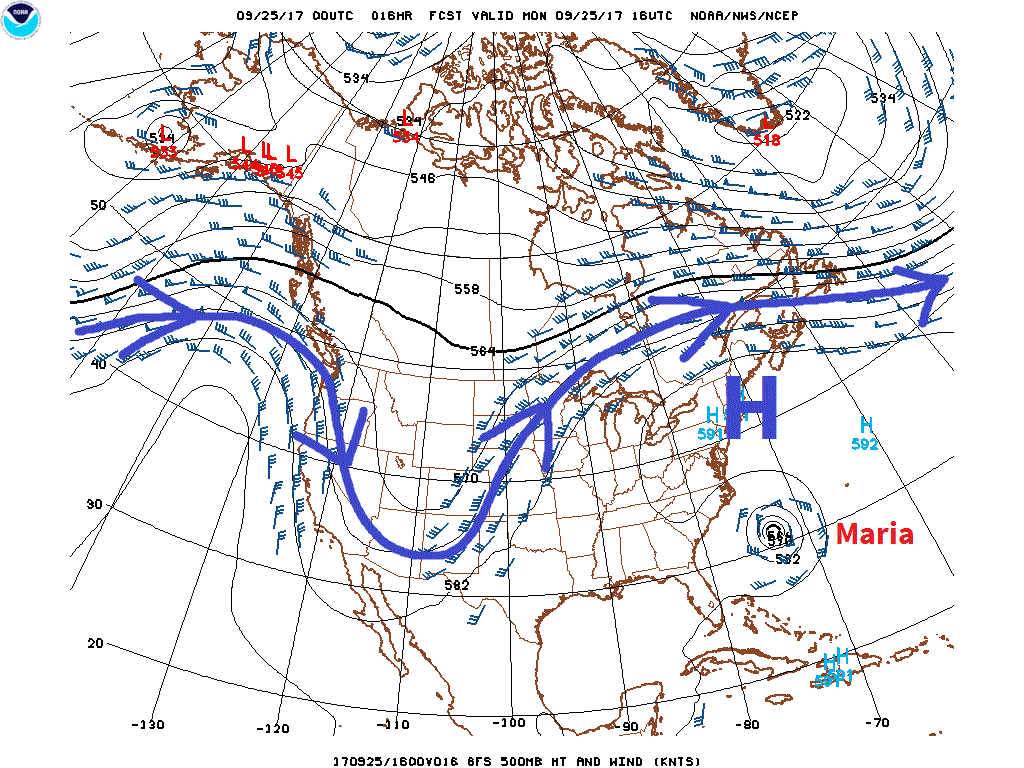
Image above shows 500 millibar level (roughly 18,000 feet above seal level today) at noon (click to enlarge). The high pressure ridge...


Calendar Says Fall, Weather Maps Say Summer
Orion is one of my favorite constellations, but it was a little disconcerting to see it, along with the Pleiades riding high in the sky...


Last Full Day of Summer
Sea level pressure, IR satellite & wind gusts (click to enlarge). Tropical storm Jose is centered about 150 miles southeast of Nantucket...


Maria Making Landfall in P.R.
Image above Via Weatherunderground Maria - a strong Cat 4 hurricane with maximum sustained wind up to 155 mph is making landfall in...


No Way, Jose
Latest Radar & Wind Gusts: Hurricane Jose's most likely track continues to trend further south & east. As a result, we will only feel...


What Effects Will Hurricane Jose Have On Our Area?
As of 8:00 A.M. Hurricane Jose was centered 270 miles East-Southeast of Cape Hatteras, North Carolina. Maximum Sustained wind is up to...

Are We Getting A Hurricane?
Back on September 9th I posted that the GFS & ECMWF models were projecting Hurricane Jose to hang around for a while, then possibly move...