
Hermine Shifts East
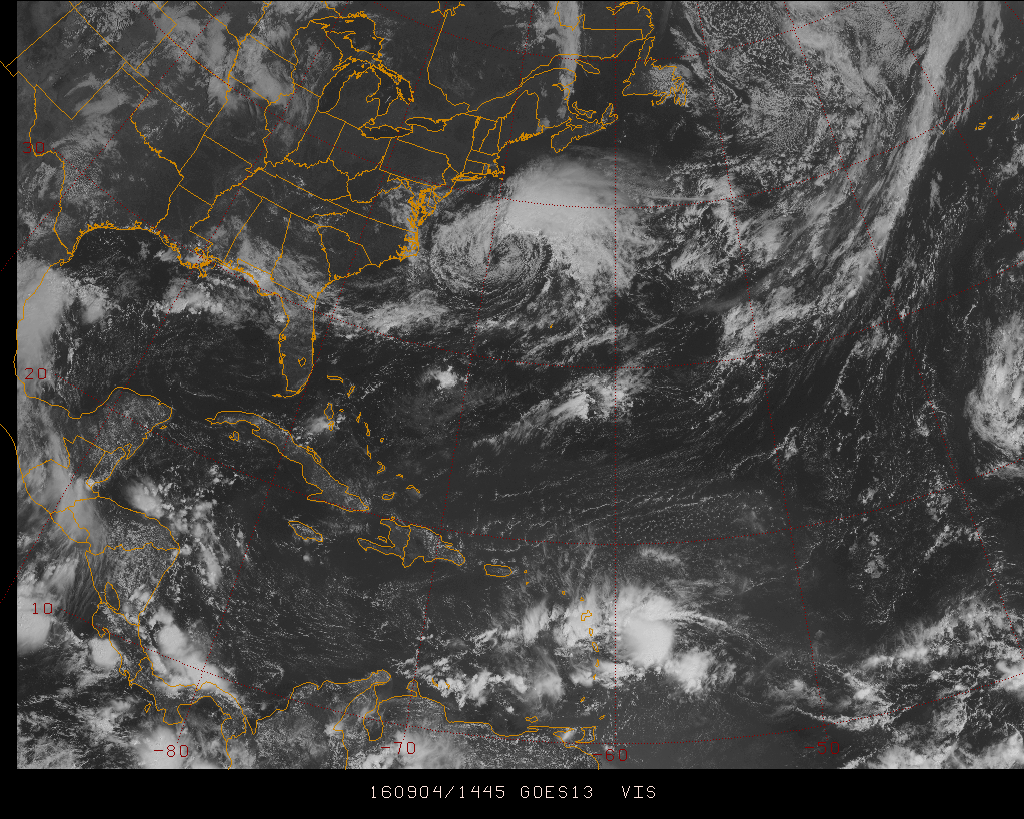
Hermine has tracked a bit further east than previous model solutions suggested, As a result, the inpact from the storm on our region will likely be less than was anticipated yesterday. Still bears watching, as the interplay between the storm and high pressure to the north is a little tricky for the models to resolve, so further tracking errors are possible.
As of right now:
1) Largest impact will be across southeastern New England.
2) Probably no rain before Monday afternoon, except eastern L.I. and southeastern New England. Best chance for showers or rain Monday night & Tuesday will be from eastern CT eastward to southeastern New England.
3) Highest wind gusts along CT shore may stay in the 20-30 mph or 25-35 mph range.
4) Gusts on eastern L.I. could ht 40+ mph.
5) I wouldn't go into L.I. Sound or the coastal waters. There are dangerous rip tides & undertow due to ocean churning & wave action.
Unless things shift back to the west this won't be that big a deal unless your in southeastern New England or far eastern L.I. Even in those places it won't be anything you haven't experienced before.


